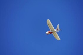
Iranian company produces light drones for mapping difficult terrains

In response to the high costs associated with using helicopters for mapping, an Iranian knowledge-based company has designed 7-kilogram drones capable of capturing images in even the most challenging terrains.
This innovation includes the use of parachutes for the drones’ descent, ensuring they land without damage.
Given that most mapping projects involve difficult-to-access areas, the drones, designed specifically for Iran’s climate, offer a practical and cost-effective solution.
Mehdi Mirasi, CEO of the company, explained in an interview with ISNA that the drones are equipped to fly at altitudes up to 4,000 meters above sea level and can stay airborne for up to 50 minutes.
Mirasi highlighted the company’s focus on designing and producing unmanned aerial vehicles (UAVs) for imaging and aerial mapping missions, noting that their drones are registered with national plates.
The CEO concluded, “The design and production of these drones are carried out entirely within our company. We are the only knowledge-based company in the country that has the license to produce mapping drones.”


