Second Iran-Geo International Exhibition opens in Tehran
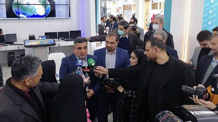
The Second Iran-Geo International Exhibition has opened in the Iranian capital Tehran where 4 knowledge-based geomatic products were put on display.
The exhibition is a venue for all companies active in the field.
The actors include companies that make devices creating spatial information, operating organizations, private companies, knowledge-based companies and universities.
The goal of the exhibition is to present the capabilities of the participating companies and to network their capacities in order to meet the technological needs of the country in the relevant field.
The exhibition hosted General Farahi, Iran’s Deputy Defense Minister, and Manouchehr Manteghi, Secretary of Iran’s Headquarters for the Development of Space Technologies and Advanced Transportation.
The systems that were unveiled at the event were an indigenous ground positioning system, a homegrown photogrammetry aerial photography system, a domestically-built GIS engine and a homegrown geomatic observatory.
The first exhibition put on display products made by 42 specialized collections such as aerial mapping with aircraft and drones for data collection, urban 3D techniques, etc.
